Gaiole in Chianti to Villa a Sesta loop

Great cycling rides logo Trek Travel

Gaiole in Chianti to Villa a Sesta Loop

Gaiole in Chianti to Villa a Sesta Loop

#6 on our Great Rides list

Tuscany

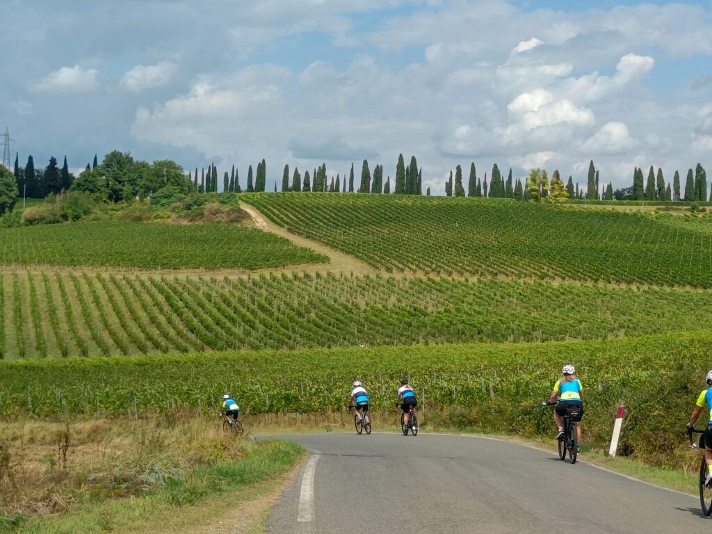
Tuscany is one of the places to cycle that people dream of. Ribbons of road carving through the mountains and hillsides, mountain tops dotted with quaint villages, world-renowned food, amazing wine, and Italian hospitality.

Location

Gaiole in Chianti, Tuscany, Italy

light blue icon link

Distance

35 miles / 56.5km

light blue two peak mountain icon

Elevation Gain

3,819ft / 1,164m

light blue cloud and sun icon

Best Time to Visit

Spring or Fall

light blue road icon

Surface

Paved Road

light blue icon that depicts that something is loading.

Difficulty

Level 3

light blue stoplight icon with boarder

Traffic

Level 1

Discover this ride on our Tuscany bike tour

Quintessential Luxury of Chianti’s Famous Castles and Wines

Truly, what more could one want and desire.

Today’s ride is a stunning loop from the village of Gaiole in Chianti heading out of the mountains and winding through the vineyards. Around 10km, the famed Castello di Brolio is just off our path. After passing the castle, the mountainous landscapes of Chianti give way to olive groves, vineyards, and gentle rolling roads snaking through the countryside. Around 30km into the ride, you will pass through Castelnuovo Berardenga, this is a great spot to refuel as you begin your ascent up Monteluco. The next 14.5km will take you to the top of today’s climb, which will average just over 3%. After ascending to the top, there is a little store to top up on water, and then you can enjoy the descent which will take you almost all the way back to our hotel.

What you need to know

RIDE DETAILS
The first 25km of today’s ride is mostly downhill, averaging -0.1%. And different points of the ride, on a clear day, Sienna is off in the distance less then 20km away.

WEATHER
Cycling in Chianti, the temperatures can be relatively cooler throughout the year, relative to those in Sienna. It is always wise to take layers with you, and prepare for the unexpected. Chianti seems to receive slightly more rain then some of the surrounding areas.

FUEL
Great locations to refuel on the ride, 10.2km there is a cafe and the Enoteca of The Castello di Brolio. The next recommended stop for food and water is just before the 30km mark in Castelnuovo Berardenga. The final spot is on top of Monteluco at 44.2km.

While you’re in town

The village of Radda in Chainti is just 11km away. For those looking to explore another quaint village with fantastic wines and restaurants, it is worth a stop. Bar Dante is a great place to sit and sip a drink, while meandering through the village you will find great cycling shops, and Enoteca’s.

If you have a desire to cycle the White Roads on a vintage bike, simply stop in to La Bottegga and talk to Emanuele Nepi (he is one of the owners). He will be able to help you find a vintage bike to rent, along with getting you in the vintage gear.

Siena is only 25km away, and it is well worth the trip. From exploring the Duomo di Siena, Tower of Mangia, and the Piazza del Campo are highly recommended. The La Bottega dei Sapori Antichi is a great spot to grab a sandwhich to go, while GROM – Il Gelato come una volta & Gelateria Kopakabana are our favorite spots for Gelato.

Ready for this ride?

Book early and save. We reward our guests with lower pricing and more dates to choose from the earlier you book. Rest assured, once you book, your price is guaranteed.
Caesar’s Head

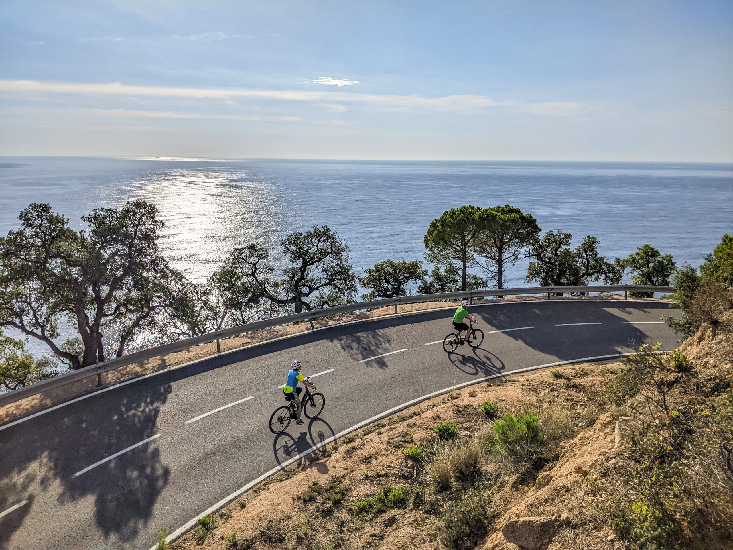
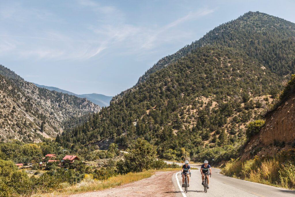
landscape shot of Ceaser's Head in Upstate South Carolina
Great cycling rides logo Trek Travel

Caesar's Head

Caesar's Head

#9 on our Great Rides list

Greenville

Caesar’s Head is a favorite ride of George Hincapie, a retired professional cyclist and local Greenville resident and a must ride if you are in South Carolina.

Location

Greenville, South Carolina, USA

light blue icon link

Distance

97 miles / 156km

light blue two peak mountain icon

Elevation Gain

7,650ft / 2,331m

light blue cloud and sun icon

Best Time to Visit

Spring - Fall - Winter

light blue road icon

Surface

Paved Road

light blue icon that depicts that something is loading.

Difficulty

Level 4

light blue stoplight icon with boarder

Traffic

Level 2

Discover this ride on our Greenville ride camp

The Pros secret training grounds

According to Hincapie, this ride “is one of the hardest climbs in the area.” and he often used it to gauge his fitness as he prepared for his 17-Tour de France participations.

The first 4-miles of the climb has a good steady gradient followed by a short reprieve, finishing with a steeper 2-miles section to the summit. The reward for conquering this challenging climb comes from the overlook at the summit of Caesar’s Head State Park, featuring breathtaking views of Table Rock State Park and the Blue Ridge Mountains. Keep a watchful eye out for some pro cyclists and junior development squads training in the early spring.

What you need to know

Ride details
The climb has pretty well maintained pavement and light traffic for most of the year. Traffic increases with the arrival of the fall foliage in October which attracts lots of folks who come to see the dramatic colored leaves in this massive deciduous forest. The top of the climb is at about mile 33, but you climbing isn’t over yet. While the climb up to Ceasars Head summit is the toughest climb, you’ll still have 64 miles and about 4,000ft left to ride to get back to Greenville, unless you choose to do the ride as an out and back.

Weather
Spring and Fall are definitely the best times tackle Caesar’s Head. Much of the climb is in a canopy of trees which offers good protection from the summer sun but it can get incredibly humid in the summer. Late spring and early fall you will get more variable weather but more comfortable humidity and less traffic. It is generally at least 10 degrees cooler at the summit, so make sure to pack layers.

Fuel
The Mountain House Restaurant just before the summit is a great place to refuel for lunch featuring sandwiches, salads, ice cream and homemade fudge. The visitor center at the top has coffee, water and snacks available, along with a fireplace to warm up before the descent on colder days.

While you’re in town

There are tons of bike shops in Greenville which off bike rentals and plenty of gear to prepare you for the Ceasars head ride! Aside from excellent road biking, Greenville boast a plethora of other activities. Hike one of the hundreds of trails in surrounding state parks, white water rafting, waterfall tours or horse back riding. Greenville truly has it all!

Greenville is quickly becoming known as a “foodie” paradise. There are over 600 restaurants in Greenville (yes, 600!) with an enticing and diverse collection of dining experiences and cuisines ranging from traditional, to global, to downright eclectic.

Ready for Caesar's Head?

Book early and save. We reward our guests with lower pricing and more dates to choose from the earlier you book. Rest assured, once you book, your price is guaranteed.

Enchanted Circle Loop

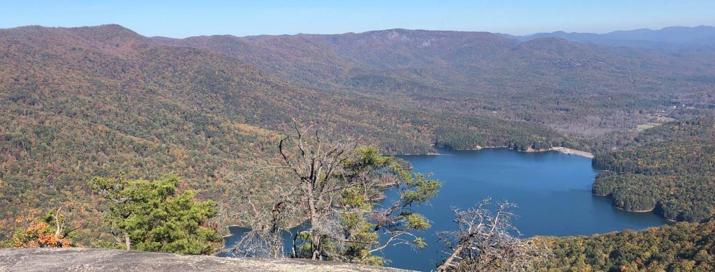
Two people riding their bikes with a mountain view in New Mexico
Great cycling rides logo Trek Travel

Enchanted Circle Loop

Enchanted Circle Loop

#10 on our Great Rides list

Taos

In a far northern corner of New Mexico at the southern end of the Rockies in a Range known as the Sangre de Cristo Mountains, you will find an epic cycling route that circles the states’ tallest mountain, 13,167 foot Wheeler peak.

Location

Taos to Red River, New Mexico, USA

light blue icon link

Distance

85 miles / 137.4km

light blue two peak mountain icon

Elevation Gain

5,902ft / 1,799m

light blue cloud and sun icon

Best Time to Visit

Spring, Summer, Fall

light blue road icon

Surface

Paved Road

light blue icon that depicts that something is loading.

Difficulty

Level 4

light blue stoplight icon with boarder

Traffic

Level 2

Discover this ride on our New Mexico bike tour

Visit Santa Fe and the Pueblos of the Southwest

The Enchanted Circle begins and ends in Taos’s historic village and home to the 1000-year-old UNESCO World Heritage Taos Pueblo.

The Enchanted Circle begins and ends in Taos’s historic village and home to the 1000-year-old UNESCO World Heritage Taos Pueblo. The challenging loop is 85 miles and requires just under 6000 ft. of climbing over two passes: Palo Flechado Pass (9112 ft.) and Bobcat Pass (9820 ft.) On this ride, you will experience many landscapes, including the sage-covered desert plateau of the Rio Grande Rift Valley, Pine and Aspen lined valleys, and views of the highest snow-capped peaks in the state. Plan on making a stop at the powerful Viet Nam Memorial outside of Angel Fire, spotting birds of prey along Eagles Nest Lake, and grabbing a quick lunch in the little ski town of Red River. While the summiting of Bobcat pass marks the highest elevation of the trip and the end of the second pass, don’t be fooled! Following 18 miles of descending, just beyond the town of Questa, over the next 12 miles, you will encounter a set of short but steep climbs that often are subject to swift headwinds, heat, or both. As you crest the Taos Plateau near Arroyo Hondo, you will gaze upon the 800 ft. deep Rio Grande Gorge, and in just 10 more miles down a false flat descent, you will arrive back in the Taos. An epic day should be rewarded by an epic meal at one of Taos’s top-notch eateries.

What you need to know

RIDE DETAILS
Featuring 5900 ft of climbing, this ride is not for the faint of heart. It is an incredibly beautiful challenge that is worth every pedal stroke. The average grade is 3.5% but you will see gradients much higher and a max grade of 11%.

WEATHER
Plan to bring layers in line with the time of year. All seasons can see a range of wet and dry hot and cold at these elevations and it is a long road if you forget your jacket and knee warmers.

FUEL
While this is an Epic ride you will find a few places conveniently located to restock on water, snacks and even lunch in Eagles Nest, Red River, Questa and Arroyo Hondo. Be prepared to pedal for 32 miles and one mountain pass before your first snack and water stop. Good lunch options can be found in Red River at 49 miles.

While you’re in town

Fly to Albuquerque, NM and rent a car to drive 2.5 hours to the beautful town of Taos where there are a plethora of outdoor actvities to keep you busy. Raft the Rio Grande or fly-fish with a local outfitter, Hot air balloon over the gorge bridge, hike the many Sangre de Cristo Trails including to the summit of Wheeler peak. Visit galleries and shops in taos. Check out the Milicent Rogers museum or book at tour of the Earth Ships.

There are many hotels and B&B’s in the area but El Monte Sagrado is by far the most luxurious and contemporary. It has an amazing pool and grounds. Casa Benavides is a great B&B with the best breakfast in town and run by long time locals the Benavides Family.

Stroll down to the Taos Plaza and surrounding downtown area to find a range of great restaurants from local brew pubs to fine dining. For your last minute bike needs, check out Gearing Up Cycling and Taos Cycling in Taos or New Mexico Bike and Sport or Melo Velo in Santa Fe.

Ready to for this ride?

Book early and save. We reward our guests with lower pricing and more dates to choose from the earlier you book. Rest assured, once you book, your price is guaranteed.
Monte Grappa Loop

Great cycling rides logo Trek Travel

Monte Grappa Loop

#11 on our Great Rides list

Monte Grappa

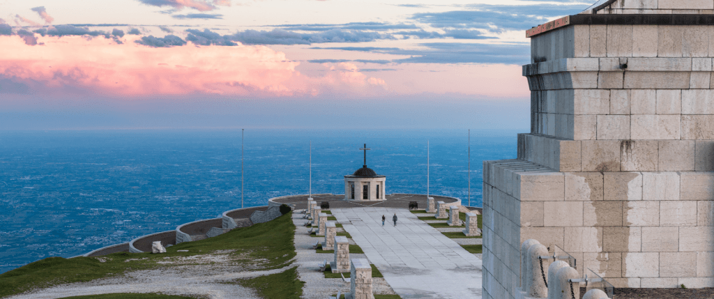
This famous climb in the Pre-Alps was a World War I battleground, and today Monte Grappa stands as a focal point of fierce Italian national pride.

Location

Asolo, Veneto, Italy

light blue icon link

Distance

45 miles / 72km

light blue two peak mountain icon

Elevation Gain

6,476ft / 1,974m

light blue cloud and sun icon

Best Time to Visit

Summer or late Spring

light blue road icon

Surface

Paved Road

light blue icon that depicts that something is loading.

Difficulty

Level 4

light blue stoplight icon with boarder

Traffic

Level 1

Discover this ride on our Giro d'Italia bike tour

Ride through the heart of the Dolomites

Monte Grappa is part of the Grappa massif, 100 km in circumferance, which straddles the provinces of Treviso, Vicenza, and Belluno in the northeast Italy’s Veneto region.

It rises from the plains to a height of 1,775 m (5,769 ft). It’s also a wonderland for cyclists, offering ten paved routes to the summit, one of which is considered one of the most beautiful and challenging climbs in Italy. The Giro d’Italia has visited Monte Grappa several times and the ride is considered a must for any cycling fan. The challenge ends at a huge Memorial monument where many soldiers were buried; this is why the Italians consider this mountain sacred. From the summit (on a clear day), you will see the lagoon of Venice in the south and the sharp summits of the Dolomites to the north. Enjoy the vistas while you have lunch at our recommended location, Rifugio Bassano. You’ll be surrounded by fields and pastures on the mountain complete with “malghe,” or alpine homes to the animals. After lunch, descend toward Romano d’Ezzelino and stop at the inn at Ponte San Lorenzo to see autographed photos of Gino Bartali and Marco Pantani. Finally retrace your steps back to your fantastic hotel.

What you need to know

RIDE DETAILS
The climb officialy starts at the church of Semonzo and for the next 6 to 7 km you will be riding in the woods and conquering a series of switchbacks. It is very important not to push hard during this first section. Average grade is around 8% and you will work your way up to switchback 20. The ascent is 11.4 miles / 18.5 km, gaining 1,514 m at an 8.3% average grade (the max grade encountered is 14%), this is the most difficult route up to Cima Grappa by bike.

WEATHER
This part of the mountain is popular for paragliding, the steepness of mountain and warm winds from the sea gives gliders a great up-lift.

FUEL
Switchback 20 marks the end of the first section. Keep in mind that if you are running low on water, stop at the Restaurant ‘Deltapiano’ (around 890 meters) to fill up otherwise you will run into problems later.

While you’re in town

At 1,360 meters you crest a small rise and finally get to see the top of the climb. From here there is a short downhill and contour before working your way up the last wall of the climbs. In the valley below you can spot the Piave River and the Asolo hills. From switchback 26 to 28 is your last grind with a couple of 11% sections. Once you pass the last switchback there is a short ramp that intersects with the main route where you can turn right and continue another 1 km to the summit at 7% grade. At the top stop at Rifugio Bassano and grab something to eat before you start a sweeping descent toward Romando d’Ezzelino.

Plan to spend at least a couple days in this area to experience the beauty and culture of this amazing part of Italy. Explore the ancient, cobblestone streets or sip a coffee as you gaze up at the challenging climb you just conquered.

Ready for Monte Grappa?

Book early and save. We reward our guests with lower pricing and more dates to choose from the earlier you book. Rest assured, once you book, your price is guaranteed.
Mirador Pucon to Curarrehue to Argentina Border

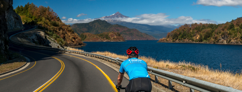
A cyclist along the lake riding towards a mountain in Chile
Great cycling rides logo Trek Travel

Mirador Pucon to Curarrehue to Argentina Border

Mirador Pucon to Curarrehue to Argentina Border

#12 on our Great Rides list

Chile

Your ride begins near the bustling town of Pucón, which is well known as Chile’s outdoor activity mecca.

Location

Pucon, Araucania, Chile

light blue icon link

Distance

80.7 miles / 130kmm

light blue two peak mountain icon

Elevation Gain

5,347ft / 1,630m

light blue cloud and sun icon

Best Time to Visit

Winter or Spring

light blue road icon

Surface

Paved Road

light blue icon that depicts that something is loading.

Difficulty

Level 3

light blue stoplight icon with boarder

Traffic

Level 2

Discover this ride on our Chile bike tour

Visit the Lakes and Volcanoes District

This ride takes you through the stunning Villarrica National Park where you will ride past expansive forests, glacial lakes, and the three looming stratovolcanoes in the Araucania region: Villarrica, Quetrupillán, and Lanín.

Enjoy the stunning scenery in the first half of the ride while you warm up for the real challenge, the 9-mile climb up to the border of Argentina via Mamuil-Mamal Pass. Your final ascent will reward you with breathtaking views of the famous Araucaria tree, Lago Quilleihue and the majestic Volcán Lanín, a dormant stratovolcano straddling the border of Argentina and Chile. Pucón is a town in central Chile’s Lake District, lying on Lake Villarrica overlooked by the snow-capped Villarrica volcano. An adventure tourism hub, it’s renowned for access to hiking trails, water sports, white-water rafting and kayaking as well as skiing and snowboarding. The surrounding terrain ranges from lakeside beaches to temperate rainforest. Natural hot springs are found in nearby forested valleys.

What you need to know

RIDE DETAILS
The ascent to the Argentine border is just over 9 miles long with an average grade of 6%. However, you will see grades of up to 13% along the way. Bring plenty of water and food for the climb as there are no reliable sources of supplies along the way. Unless you are legitimately traveling through the border and plan to stay in Argentina, do not attempt to cross the border. This could result in a sticky situation unless you have all the pertinent paperwork.

WEATHER
Weather can change rapidly and can be much colder at the top of the climb. Be prepared and bring layers, even if it seems warm when you start your ride, climbing 3500ft to the top of a mountain always warrants dramatic weather. Wind can be fierce near the top of the climb where it is more exposed. We recommend to use extreme caution when descending from the border as the wind can blow you right off the bike. Keep your areo bikes and deep dish wheels at home!

FUEL
Bathrooms can be found in the border control building just inside the entrance and are free of charge.

While you’re in town

Pucón is home to many beautiful shops with local jewelry, art, clothing, and other wares. You can also find outdoor clothing and gear shops such as Patagonia and Jack Wolfskin for your outdoor adventure needs.Stay at Hotel Antumalal on the outskirts of Pucón for quietude and spectacular views of Lago Villarrica. For a more local stay within walking distance to shops and restaurants, stay at Hotel Casa Solaria.

If more adventure and a test of fitness is your style, consider a guided hike to the top of the Villarrica Volcano. There are many outfitters in the town of Pucón that offer the hike.

Explore the region’s numerous natural hot springs, or “termas” in Spanish. Most are located within a short drive from Pucón.

Ready for this ride?

Book early and save. We reward our guests with lower pricing and more dates to choose from the earlier you book. Rest assured, once you book, your price is guaranteed.
Orcas Island Loop

Orca Island view
Great cycling rides logo Trek Travel

Orcas Island Loop

#13 on our Great Rides list

San Juan Islands

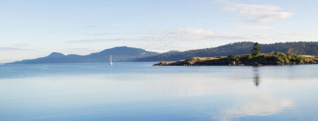
Orcas Island is part of the archipelago of the San Juan Islands in the Pacific Northwest.

Location

Eastsound, Washington, USA

light blue icon link

Distance

44 miles / 71km

light blue two peak mountain icon

Elevation Gain

4,347ft / 1,325m

light blue cloud and sun icon

Best Time to Visit

Summer or late Spring

light blue road icon

Surface

Paved Road

light blue icon that depicts that something is loading.

Difficulty

Level 2

light blue stoplight icon with boarder

Traffic

Level 1

Discover this ride on our San Juan Islands bike tour

Washington State's Multisport Paradise

The ride through the island takes you up and down small hills that keep even the best cyclist on their toes.

Riders will be surrounded by the deep green and towering trees that is characteristic if the pacific northwest- pair that with the low population of the island and you feel transported to a simpler time. Views of the bay and a stop at Orcas Island Pottery to see local artists work keeps anyone enthralled. When you need more challenge than the rolling hills, enter Mt Constitution – five miles of winding upward through lush forest to an incredible 360 degree view overlooking the island dotted seas off the coast of Washington and British Columbia. 

What You Need to Know

RIDE DETAILS
San Juan Archipelago consists of over 400 islands with 128 of them named and only a handful inhabited. There is not a single traffic light on the San Juan Islands.

WEATHER
Though the San Juans are in the rain shadow of the Olympics and thus experience far less rain than the rest of the pacific northweat, always be ready for possible rain. The average highs in the summer barely break the 70s, and when you climb MT Constitution, it can be 10 degrees cooler at the top, so bring layers.

FUEL
The island has some punchy hills, but many, when riding the rolling hills, underestimate Mt. Constitution. Be ready for it mentally and keep your fuel level high.

While You’re in Town

Rent a kayak or SUP down the road from Eastsound at Crescent Beach Rentals; Rent a Trek bike from Wildlife Cyles and grab a treat from Rose’s bakery before riding away.

Whale watching tours are available all over the island. Be sure to get on one for an unforgettable experience.

Ready for Orcas Island Loop?

Book early and save. We reward our guests with lower pricing and more dates to choose from the earlier you book. Rest assured, once you book, your price is guaranteed.
Mt. Mitchell Summit Return

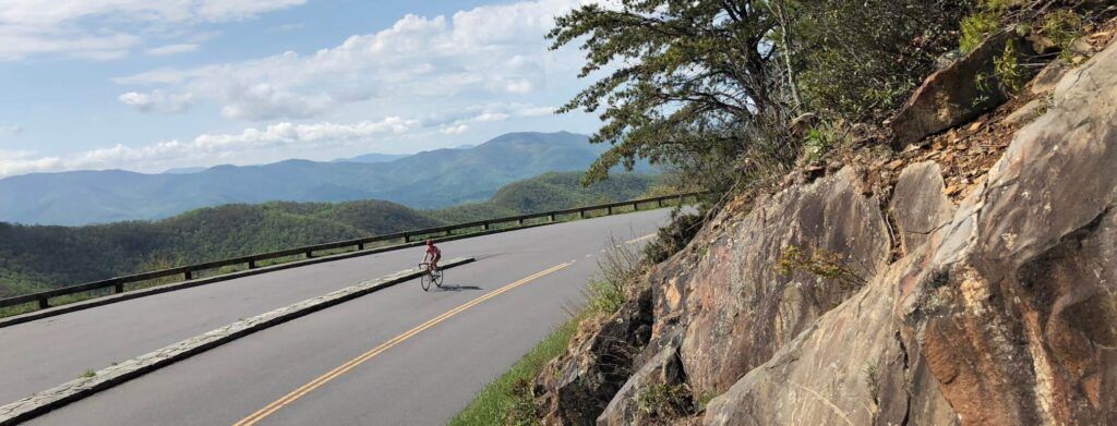
A person biking on Mt. Mitchell North Carolina
Great cycling rides logo Trek Travel

Mt. Mitchell Summit Return

#7 on our Great Rides list

Mt. Mitchell Summit Return

This ride climbs slowly but surely up and out of the beer, biking, live music and outdoor activity mecca of Asheville to the summit of Mt Mitchell, the highest peak east of the Mississippi.

Location

Asheville, North Carolina, USA

light blue icon link

Distance

70 miles / 113km

light blue two peak mountain icon

Elevation Gain

7,900ft / 2,407m

light blue cloud and sun icon

Best Time to Visit

Spring or Fall

light blue road icon

Surface

Paved Road

light blue icon that depicts that something is loading.

Difficulty

Level 4

light blue stoplight icon with boarder

Traffic

Level 1

Discover this ride on our Asheville bike tour

The Blue Ridge Parkway and the Southern Appalachians

You’ll travel from the dense, deciduous forests surrounding Asheville up into the rocky, exposed, alpine environment up on Mt. Mitchell.

You’ll experience quick switch backs right out of Asheville before hopping on the iconic Blue Ridge Parkway where the climbing continues up nearly 6,100ft in 36 miles. Famous for its beautiful views of the Black Mountains, vast surrounding wilderness and incredible foliage and wildlife, a ride on the Blue Ridge Parkway should not be passed up. This climb is very long and not for the faint of heart but, don’t let this scare you away because every pedal stroke and 15% grade are worth it for the incredible 360 degree views of this special part of North Carolina.

What you need to know

RIDE DETAILS
This climb is very long and not for the faint of heart but, don’t let this scare you away because every pedal stroke and 15% grade are worth it for the incredible 360 degree views of this special part of North Carolina. Don’t burn all your matches on the ride up because, as you can see in the elevation profile, there is still some significant climbing on the way back down to Asheville. The pavement is in very good condition for the entire Blue Ridge parkway. As a state park, it is well maintained and there is a sizable bike lane for the entire ride. It is important to note that on occasion, the parkway will be closed to bikes and vehicle traffic. This can happen during extreme storms and for much of the winter months.

WEATHER
The weather changes very rapidly in this area. It can be sunny and 85 degrees down in Asheville and windy, dumping rain and 40 degrees up at the summit of Mt. Mitchell. Definitely be prepared to take off and put on layers many times and keep an eye out for storms rolling in.

FUEL
Once leaving Asheville, there are very few resources on the Blue Ridge Parkway. Your first opportunity to use facilities will be at mile 23 at the Craggy Gardens visitors center where there are light snacks, souvenirs and restrooms. There are a handful of facilities and campsites after you turn off the Blue Ridge Parkway to continue to the summit of Mt. Mitchell but they can not always be counted on being open depending on the time of year.

While you’re in town

Asheville is a mecca on the east coast for beer enthusiasts. There are a number of smaller local breweries and several larger, west coast based breweries such as New Belgium and Sierra Nevada that have breweries in the area. Plenty opportunities for a post ride beer!

Asheville is also incredibly popular for live music. Nearly every night of the week, you can find a string band playing live at a bar or venue nearby. In addition to the music scene, Asheville boasts many other festivals featuring local art, culinary events and performing arts. You will nearly never be bored in this town.

While road bike riding is very popular in Asheville, they also boast a slew of other outdoor activities. Rent kayaks or paddle boards and float the French Broad river, pedal the hundreds of miles of single track in the Pisgah national forest on your mountain bike or enjoy one of the many hikes up on the Blue Ridge parkway.

Ready for this ride?

Book early and save. We reward our guests with lower pricing and more dates to choose from the earlier you book. Rest assured, once you book, your price is guaranteed.
Ronde van Vlaanderen Citizens Ride

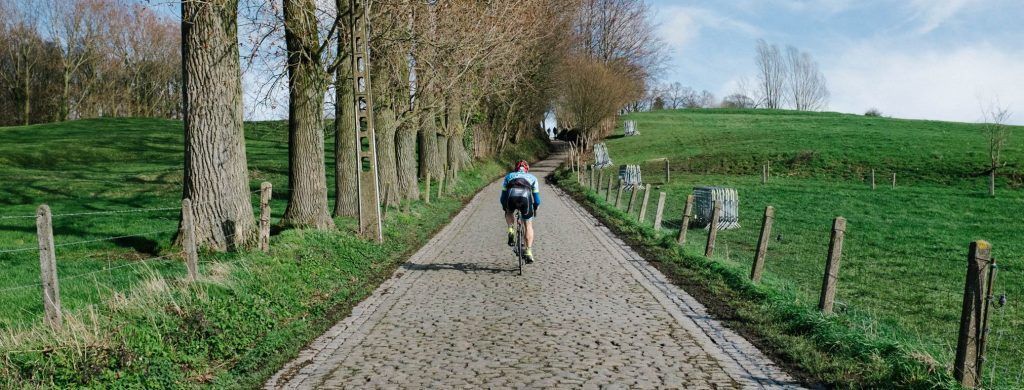
rear view of cyclist riding their bike on a cobblestone road
Great cycling rides logo Trek Travel

Ronde Van Vlaanderen Citizens Ride

Ronde Van Vlaanderen Citizens Ride

#14 on our Great Rides list

Spring Classics

Every spring since 1913, as the temperatures rise, cycle racing returns to Belgium for De Ronde. De Ronde van Vlaanderen (Tour of Flanders) is the largest Pro and amateur cycling race weekend in Belgium.

Location

Oudenaarde, Flanders, Belgium

light blue icon link

Distance

46 miles / 74km

light blue two peak mountain icon

Elevation Gain

2,724ft / 830m

light blue cloud and sun icon

Best Time to Visit

Spring or Summer

light blue road icon

Surface

Paved Road

light blue icon that depicts that something is loading.

Difficulty

Level 4

light blue stoplight icon with boarder

Traffic

Level 1

Discover this ride on our Spring Classics bike tour

Experience the Tour of Flanders and Paris-Roubaix

Being one of the five major cycle racing monuments, and one of the two cobbled classics, De Ronde weekend is special for those in Flanders, and rooted deeply in Flemish Nationalism.

Since the races conception, its purpose was to cross as many cities as possibe to unit the people for Flemish Liberation. Today it has not only united the region, but it unites people from all over the world. The day preceeding the Pro race is the “We Ride Flanders Cycling Sportive.” Due to its global popularity, registration is capped at 16,000 participants. Racers have the opportunity to ride and race on a similar course as the Pros, but being able to choose between courses of 74, 142, 177 and 235 km. Today we will ride the Sportive, enjoying 74 km of the Flemish countryside, traversing the narrow roads and punching bergs of the WorldTour.

What you need to know

RIDE DETAILS
From the weather to the challenging terrain, it is ideal to have a good riding setup. We recommend using 28c tubeless tires, a compact riding setup for the punchy climbs, and shoes that you can walk in should the need arise. Having handlebars that have extra padding or have been double wrapped go along way for the hands. Using water bottle cages, like Trek’s bat cage, will ensure your bottles stay in place. And riding a bike like Trek’s Domane, with its Isospeed Tech will ensure your body does not get beat up by the cobbles.

WEATHER
The temperatures in Belgium from late March to early April average in the low’s around 5 °C to the highs between 13 – 18 °C. The amount of rain in March to April is normal with an average of 31mm. The locals considered this a chilly month. Due to the variance in weather and tempartures, it is best to be prepared for anything during the Sprotive. Bring layers, warmers, shoe covers, riding gloves, and rain gear. It is better to have gear not need it, rather then needing it and not having it.

FUEL
The We Ride Flanders RVV Cyclo Sportive does a great job offering support for its participants, from food to bike mechanics. However, imagine trying to support 16,000 of your best friends. Either knowing specifically where to get food and fuel is key. Or carrying enough food with you for the day is ideal. One advantage of going with Trek Travel, is that we will take care of all these things for you. We have our own private feed zones set up along the course, and should you have a mechanical, we can fix it for you. Also, you can drop off a change of clothes should the weather change from the start to the finish of the race.

While you’re in town

The sprotive courses have four options, 74, 142, 177 and 235 km.The only course that does not start in Oudenaarde, is the longer option (235km). The longer course mirrors the pro race. The shorter courses do loops from Oudenaarde, and we find that for most people, the shorter courses offer more then enough cycling excitement in the Flanders region.

Our favorite location to base ourselves for the We Ride Flanders Cyclo Sportive is Bruges. This is a roughly a one hour shuttle to Oudenaarde. Bruges offers us a unique base, with great cycling to warm up our legs, fantastic hotels, and lovely city to explore and rest between the rides. Also, Bruges is easy to get to from anywhere in Belgium.

The Belgians offer cyclists many delights, chocolate, waffles, and frites to name a few. But one of the best aspects of being in Belgium is the amazing beer. In Bruges, there are fantastic establishments to try and enjoy new and old beer favorites. There is the Huisbrouwerij De Halve Maan where one can do a tour and taste some of the nectar of the gods. While, just over an hour from Bruges is the world reknowned Saint-Sixtus Abbey of Westvleteren. Sint Sixtus is one of the most sought after beers in the world. Partially because most consider Westvleteren 12 to be the world’s finest beer. Secondly, you can only get the beer from the monks at the Abbey. It is well worth a trip to Westvleteren. And if you travel with us, not only will you venture to Westvleteren, but we will cycle some of the famous cobbled roads nearby, then sit back and enjoy the worlds finest beer at Saint-Sixtus Abbey of Westvleteren.

Ready for this ride?

Book early and save. We reward our guests with lower pricing and more dates to choose from the earlier you book. Rest assured, once you book, your price is guaranteed.
Healdsburg to Redwoods

A road in Healdsburg, California
Great cycling rides logo Trek Travel

Healdsburg to Redwoods

Healdsburg to Redwoods

#15 on our Great Rides list

Healdsburg

Located 1 hour northwest of the Napa Valley sits a bike and wine enthusiasts paradise in Healdsburg, California.

Location

Healdsburg, California, USA

light blue icon link

Distance

45 miles / 72km

light blue two peak mountain icon

Elevation Gain

3,285ft / 1,001m

light blue cloud and sun icon

Best Time to Visit

Spring or Fall

light blue road icon

Surface

Paved Road

light blue icon that depicts that something is loading.

Difficulty

Level 3

light blue stoplight icon with boarder

Traffic

Level 2

Discover this ride on our California Wine Country bike tour

Visit Sonoma and the Russian River Valley

This ride takes you on a meander through vineyard heaven as it winds toward to Pacific ocean via the famous Russian River Valley.

You’ll pass many iconic wineries such as Korbel and La Crema and Trek Travel favorites such as Gary Farrell, Porter Creek and Armida before hopping off the beaten path to climb up and over the, very little travelled, Sweetwater Springs road. The terrain dramatically changes from the hot and dry Alexander and Dry creek valleys to a much more wet and temperate, Pinot Noir producing Russian River valley as soon as you descend off Sweetwater springs road. You’ll then feel transported into the fairyland that is Armstrong Redwoods state park, where trees grow over 300ft and are 1,400 years old. We bet you’ve never experienced anything like this.

What you need to know

RIDE DETAILS
Sweetwater springs climb is very steep, narrow and, in some parts, the road is quite rough. We recommend a 28mm tire at the minimum to increase comfort. We can’t recommend anything to help your legs up this steep climb, but a wider tire will at least help to dampen the road roughness. For the rest of the route, the pavement is in great condition and more rolling and windy hills.
Road quality is generally quite good on this route, however watch for sections of pavement which may have been affected by recent flooding, or gravel washed onto the road after rainfall.

WEATHER
There is no charge for cyclists at the Armstrong Redwoods, ride your bike in and bask in the incredibly old and massive trees. Don’t forget your jacket as it can be significantly colder beneath the shade of the redwoods than it is in Healdsburg.

FUEL
Between Healdsburg and Guerneville, there aren’t any stops for supplies…unless you are in the mood for a wine tasting, in which case, there are about a hundred options just off the road. The small town of Guerneville, located right down the road from Armstrong Redwoods, offers a handful of coffee shops, restaurants and resupply options. On especially hot days, grab a sandwich to-go and head down to one of the many parks along the Russian River for an opportunity to relax in the shade or take a dip in the river before heading back to Healdsburg.

While you’re in town

Plan to spend at least a couple days in the Healdsburg area while there are ample rides, great opportunities for shopping, excellent restaurants in about every cuisine and, of course, WINE!

While Headsburg is a quaint tourist town, there is everything you will need on your adventure from large grocery stores and boutique hotels, to bike shops that rent bikes and private wine tasting rooms.

Famous for its sparkling wines, Korbel winery offers an excellent tour every hour during peak season (check their website before visiting). The tour features a tasting of their iconic wines, an excellent tour of their cellars and property and a tasty deli. We recommend stopping here for lunch and exploration on your ride back to Healdsburg!

Ready for this ride?

Book early and save. We reward our guests with lower pricing and more dates to choose from the earlier you book. Rest assured, once you book, your price is guaranteed.
Hvar to Jelsa Loop

Great cycling rides logo Trek Travel

Hvar to Jelsa Loop

#16 on our Great Rides list

Dalmatia

Cycling in Croatia and on the Dalmatian Islands is what dreams are made of.

Location

Hvar, Dalmatia, Croatia

light blue icon link

Distance

40 miles / 64km

light blue two peak mountain icon

Elevation Gain

3,874ft / 1,180m

light blue cloud and sun icon

Best Time to Visit

Spring or Fall

light blue road icon

Surface

Paved Road

light blue icon that depicts that something is loading.

Difficulty

Level 3

light blue stoplight icon with boarder

Traffic

Level 1

Discover this ride on our Croatia bike tour

Visit Dubrovnik, Korcula, Hvar, and Split

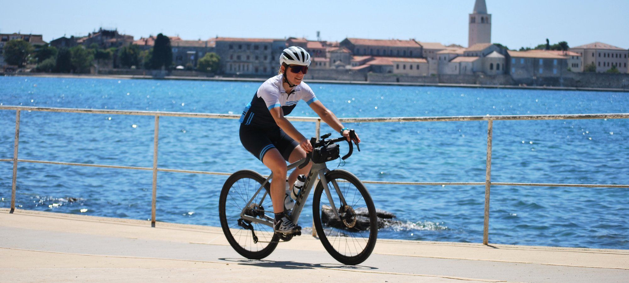
Beautiful and smooth rolling tarmac, unique and stunning landscape, and the topaz blue of the Adriatic Sea.

Today’s journey is a figure eight loop ride on the Island of Hvar. We begin our ride leaving the town of Hvar with the Adriatic sea to our right. The rolling and sometimes punchy short climbs lightly sting the legs, but the smooth rolling pavement, shimmering sea, and rugged landscape easily take our minds away from any pain. About 5km into our journey, we trade the main road for one less traveled. Soon it feels like we have been transported into the past, and we are cycling through a canyon that time feels like it forgot. This quiet road weaves us past Malo Grablje (a forgotten village), before arriving to our first stop of the day at the top of our climb, Vidikovac Levanda. We continue on with an awesome descent, and weave our way through villages, famrland, and coastal views to Jelsa. After spending some time exploring, we loop our way back to Vidikovac Levanda, before having another stunning descent to past Brusje and into Hvar. Today’s ride is one that will sit with you for years to come.

What you need to know

RIDE DETAILS
Today’s main climbs are 5.4 km at 5.4% and 11km at 4%. While the climbs may sound challenging by first read, just know that they are extremely manageble, and there is so much to see and learn and feel. It is best to take your time and enjoy the ride! The descents on the island are spectacular. Being mindful of safety is key. In some sections, there is no guardrail and the drop off can be significant. Give yourself plenty of room while descending, and if you want to enjoy the view, just pull over in a safe area. Have fun, be safe, and enjoy the ride! All over the island of Hvar are these amazing stone walls. While no one knows for certain who built them, one theory holds true today. These walls were built by farmers clearing the land so that crops could be planted. Today, the stones remain between patches of land, gnarled vines, silver tipped olive trees, and lush vegetables. They are a view worth stopping to take in.

WEATHER
The best times to visit Hvar are the spring and autumn months, as the number of tourists are less. The temperatures in the spring and fall the temperatures average in the mid 20’s° C, with about 5 days of rain per month. July and August are the warmest and driest months, while November through April are the wettest and January/February are the coldest with highs averaging 13°C.

FUEL
Vidikovac Levanda is a fantastic place to purchase a Croatian cycling jersey, or that unique small gift you want to get for friends back home. It also happens to be at the top of the climb. So it is a great spot to have a drink and take in the views.

While you’re in town

If you love amazing local wines, cured meats & cheese, and ambience filled with comfortable couches, classic rock, candle light, all packed into a small side street, then Wine Bar Pršuta 3 is for you. Locally owned and operated, Wine Bar Pršuta 3 is the place to be. There is no better place to sit back and enjoy the evening with friends then this small and unique wine bar. Not to mention, the music will take you back to childhood, while the wine is amazing.

Tired of the bike? Fan of the movie “Herbie the love bug”? Then why not explore Hvar in a vintage VW Beetle. Rapidus Car Hire rents out vintage and fully restored VW Beetle’s per day. With a wide array of hardtops and convertibles, in a variety of colors, this is an amazing way to explore the Island and find some hidden beaches.

One thing cyclists all love is gelato. One of our favorite spots on Hvar is in Jelsa, “The Eis Caffe.” With fantastic outdoor seating & limited indoor seating, the flavors & pastires are fantastic and tasty.

Ready for Hvar to Jelsa Loop?

Book early and save. We reward our guests with lower pricing and more dates to choose from the earlier you book. Rest assured, once you book, your price is guaranteed.
Private

If a date is marked as Private, it is reserved for a private group.

Don’t see exactly what you are looking for or looking for a custom date?
Call our trip consultants at 866-464-8735

What is the Difference?

Ultimate Luxury:

Savor some of the most spectacular, 5-star properties in the world. Exuding luxury and elegance, these one-of-a-kind accommodations offer the chance to rejuvenate at award-winning spas, dine at Michelin-starred restaurants, and more.

Luxury:

Enjoy luxurious accommodations handpicked for a refined experience. From signature spa treatments to delicious local cuisine, you’ll be more than provided for; you’ll be pampered.

Explorer:

These handpicked hotels provide relaxation and fun in a casual and comfortable environment. Delicious cuisine and great service mix perfectly for a memorable stay.

Combined:

On select cycling vacations, you’ll stay at a mix of Explorer and Luxury hotels. Rest assured, no matter which hotel level you’re at, our trip designers carefully select every accommodation.

Activity Level

Level 1:

Road: 1-3 hours of riding. Up to 25 mi (40 km). Up to 1,000 ft (300 m).

Gravel: 1-3 hours of riding. Up to 20 mi (35 km). Up to 1,000 ft (300 m).

Hiking: 1-3 hours of hiking. Up to 5 mi (8 km). Up to 1,000 ft (300 m).

Level 2:

Road: 2-4 hours of riding. 20-35 mi (35-60 km). Up to 2,500 ft (750 m).

Gravel: 2-4 hours of riding. 15-30 mi (25-45 km). Up to 2,000 ft (300 m).

Hiking: 2-4 hours of hiking. 4-8 mi (6-12 km). Up to 1,500 ft (450 m).

Level 3:

Road: 3-5 hours of riding. 25-55 mi (40-85 km). Up to 4,500 ft (1,500 m).

Gravel: 3-5 hours of riding. 20-40 mi (35-60 km). Up to 3,000 ft (900 m).

Hiking: 3-5 hours of hiking. 6-10 mi (9-16 km). Up to 2,000 ft (600 m).

Level 4:

Road: 4+ hours of riding. 40-70 mi (60-110 km). Up to 8,000 ft (2,400 m).

Gravel: 4+ hours of riding. 30-50 mi (45-80 km). Up to 4,000 ft (1,200 m).

Hiking: 4+ hours of hiking. 7-15 mi (11-24 km). Up to 4,000 ft (1,200 m).

What are your trip styles?

Classic - Reserve:

Savor the finer things as you relax in luxurious 5-star accommodations and wine, dine, and ride in some of the most unforgettable destinations around the world.

Classic - Signature:

Explore beautiful destinations by bike, enjoy extra inclusions, savor delicious local cuisine, and enjoy the perfect mix of accommodations.

Classic - Discover:

Enjoy a casual cycling vacation with fantastic routes and comfortable accommodations.

Ride Camp:

Train like the pros in some of their favorite riding destinations.

Pro Race:

See the pros in action at the biggest cycling events of the year.

Cross Country:

Tackle an epic adventure that takes you point-to-point across mountains, countryside, and more.

Self-Guided

Enjoy a bike tour on your schedule with just your chosen travel companions.

Single Occupancy

Sometimes it’s more convenient and comfortable to have your own room while on vacation. We understand and that’s why we offer a Single Occupancy option. The additional price guarantees a private room all to yourself